
How a Redlands Street Directory Search Unfolds
An address-first street directory is a chain of checks. Locate the parcel and APN first. Then compare the assessor owner with the situs and mailing fields, walk the same street in GIS, apply the voter rules, and trace recorded parties. An older directory comes last, as a listed household clue rather than proof of current occupancy.
Redlands is in San Bernardino County but is not the county seat. That matters when a street question reaches an original deed, map, or county counter. City records and county records have different custodians, even when the mailing line says Redlands.
- Start with the physical address. In San Bernardino County govPIMS, choose Address Search and enter the situs street number and name. Save the APN, site address, assessed owner, and owner mailing address as separate facts.
- Walk the parcel map. Open the City of Redlands GIS viewer, pan along the street, and click each parcel. The APN bridges the map, assessment record, and deed work.
- Apply the voter rule. My Voter Status checks one's own registration with identity fields. It is not a street browser. Other-voter files require a qualifying purpose, application, identification, fee, and security plan; protected voters are excluded.
- Trace the recorded chain. Search the Recorder self-service index by owner as grantee. Match the legal description, record the grantor and document facts, then search that grantor as an earlier grantee.
- Add historical clues. Compare ownership periods with a criss-cross directory, census, newspaper, or probate record. Ask the A.K. Smiley Heritage Room about shelf holdings; the verified 1936 volume is also in the FamilySearch Digital Library.
Redlands Records Arranged by Street
A Redlands street directory works as layers, not one list. Assessment and GIS records start the current address trail. Deeds add transfers, permits add work history, voter information follows access rules, and historical directories identify only listed people. An APN connects the layers but does not confirm occupancy.
| Record set | Keeper | What the street view can show | Access |
|---|---|---|---|
| Assessment roll | San Bernardino County ARC Assessor | APN, situs, owner, mailing, values, exemptions | Free govPIMS; valuations 1978 to present |
| Parcel and boundary map | City of Redlands GIS | Parcels, address parts, ZIP, legal fields, zoning, jurisdiction | Free; General Plan cap 3,000, Cityworks cap 1,000 |
| Recorded documents | San Bernardino County Recorder-Clerk | Grantors, grantees, title, date, document number | Free index; copies and office viewing |
| Permits and code cases | Redlands Building Safety | Permit number, category, address-linked context | Status needs number; request underlying records |
| Voter file | California Secretary of State and county elections officials | Approved-purpose fields, not an open street roster | Self lookup or qualifying application |
| Historical directory | A.K. Smiley Heritage Room | Listed name, address, and period clues | Local access; verified 1936 volume online |
Join APN to legal description, not street name alone. Street labels vary; tract or lot keeps the same land in view. Mailing data can point away from the parcel, while GIS can show ZIP, ParcelInRedlands, and jurisdiction together.
govPIMS Fields for a Redlands Address
County govPIMS locates a parcel by APN, physical address, or owner name. The map centers on the match and fills Search Information. The ARC property-information page and its official user guide describe those modes. Current autocomplete and every live result field were not verified.
ARC declines special queries. Historical assessment valuations cover 1978 to present. Assessment data locates and compares a parcel; it does not establish permitted use or legal title.
The assessor's owner field is an assessment clue. It can differ from the owner mailing line, a trust or business name, or the person using the parcel. Preserve the exact field labels when comparing one street segment with another.
| Search mode or field | What to enter | What it contributes |
|---|---|---|
| Parcel Number / APN | Full assessor identifier | Stable county key and map center |
| Address Search | Street number and physical name | Situs match; not the mailing line |
| Owner Search | Name as the roll records it | Ownership lead; trust and business names vary |
| Search Information | Populates after selection | Selected-parcel context; live result fields unverified |
Situs locates the land. Mailing data identifies where an assessment notice goes. Matching lines can support an owner-occupancy clue, but they do not prove who is present. A different line can reflect a trustee, absentee owner, or other official contact.
The county property-information page is the source for the image below. It shows the assessor as an address starting point, not a full people list.
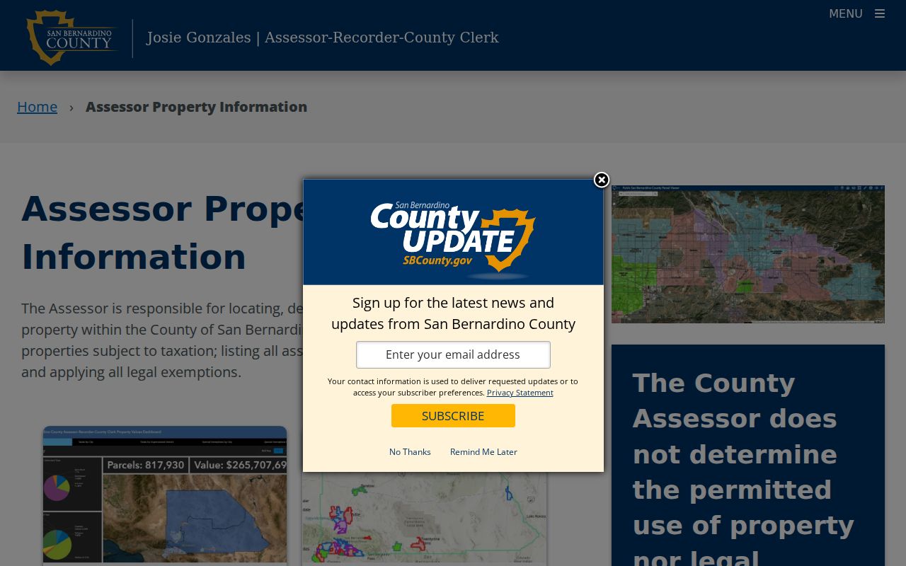
Save the parcel result with its access date before moving to GIS or deeds.
Browse Redlands GIS Along the Street
The City GIS supports a street-by-street pass and separates location, service, and boundary fields. Its General Plan parcel layer includes APN, site address parts, ZIP, owner and mailing fields, legal description, tract, lot, transfer data, and ParcelInRedlands. A backend field may not appear in every popup.
Use the address locator, zoom to parcel lines, select the target, then click adjoining polygons. Turn on City Boundary, Sphere of Influence, parcels, zoning, and transportation. Cityworks adds permits, code enforcement, flood, fire, historic, and zoning context through its layer legend.
The catalog names address services such as Address_Points_Suggest and SDE_CityworksAddressLocator. They help center a map; they do not make the map an occupant directory.
- Use APN to hold the parcel identity while the map view changes.
- Compare site address, ZIP, owner fields, and mailing fields without merging them.
- Check
JurisdictionandParcelInRedlandsbefore routing a permit question. - Treat SQL, distance, statistics, and pagination as technical layer abilities, not promises that every public control is exposed.
The General Plan service caps queries at 3,000 records. Cityworks caps at 1,000 and maps from 1:50,000 to 1:500. A visual parcel walk can be clearer than a broad export.
Parcel, Situs, Plat, and Criss-Cross Meanings
One address label can hide several kinds of location evidence. These terms keep the county roll, city map, deed, and historical directory in their proper lanes.
- Parcel
- Land tracked by an APN. Its structure or use may not be clear from the street label.
- Situs address
- The physical location assigned to land or a building, distinct from the owner mailing address.
- Plat
- A recorded map of lots, blocks, streets, or a subdivision. It connects an address to tract and lot facts.
- Criss-cross directory
- A reverse directory arranged by address or street. It may list a period household clue, not current occupancy.
An APN, map-book reference, legal description, and street address are related but not interchangeable. BBBBPP and BBBBiN are map formats, not complete APNs. Tract and lot often provide the stronger deed check.
Following the Redlands Deed Trail
The Recorder index is a grantor and grantee catalog, not a street search or online deed-image library. Start with the current owner clue from govPIMS, match the legal description, then search the named seller as an earlier grantee. Keep document number, title, date, parties, and book or page facts.
The county's property-research guide explains the backward method. A same-name match without the same land is not enough, and deeds show transfers rather than every person who used a parcel.
The county property-research guide is the source for the chain-of-title image below.
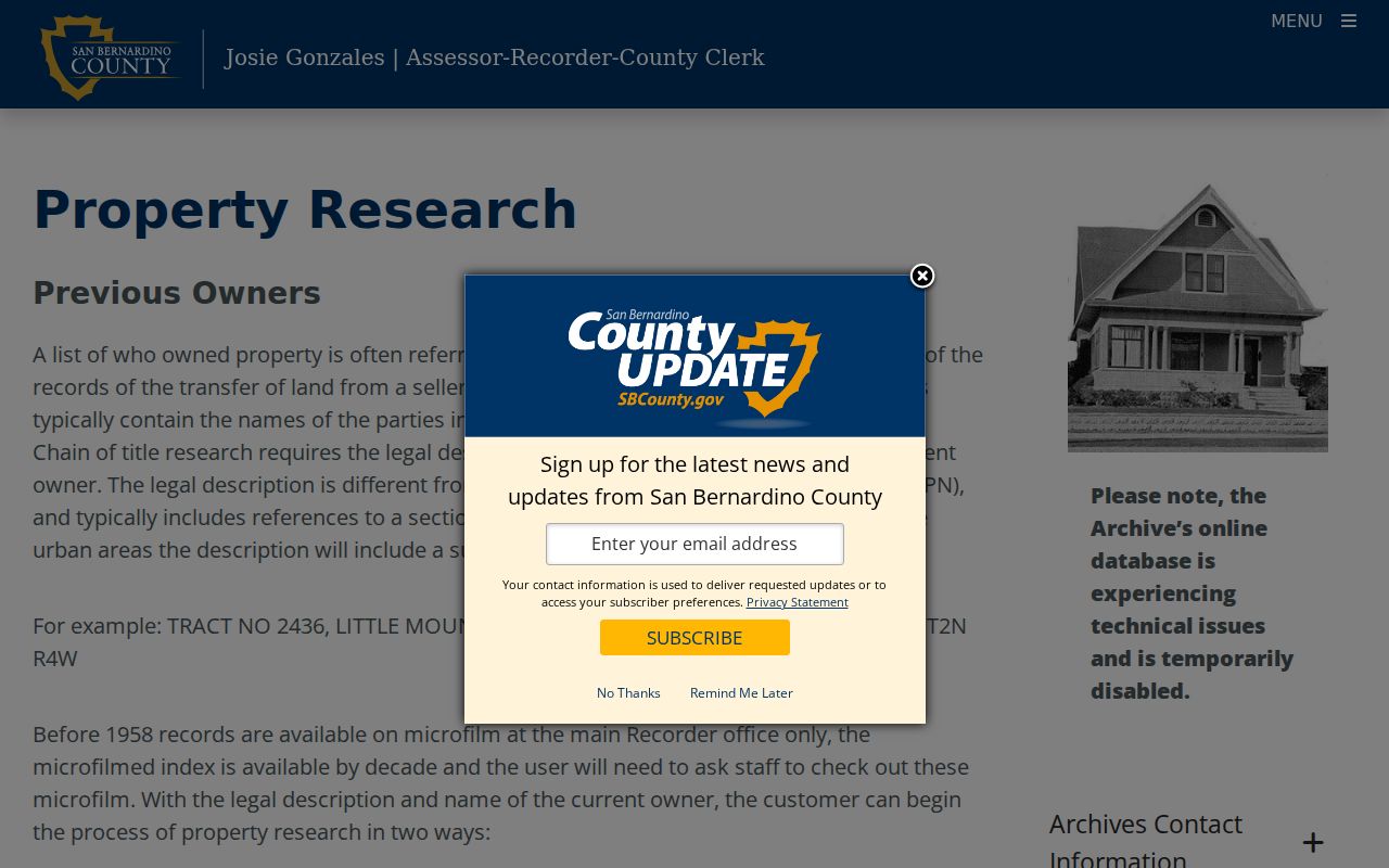
Carry tract, lot, or subdivision forward when street wording changes. An old address is not a legal description.
Redlands Street Deed Index Access
The San Bernardino County official-records page says Document Search reaches 1925 to present. The property-research guide describes online and office chain work from 1958 to present. The figures may describe different components, so confirm the 1925 to 1957 range with staff.
The self-service portal begins with reCAPTCHA and I Accept. Its index is like a library card catalog, not the instrument. Search spelling variants. Government Code §6254.21 is cited for the online image restriction; instruments are viewed at Hall of Records or High Desert.
The ARC office is at 222 W. Hospitality Lane in San Bernardino. The Recorder-Clerk line is 909-387-8306 and the Assessor line is 909-387-8307. Mail, online ordering, office viewing, and microfilm are different access channels, not interchangeable copies.
| Recorder control | Purpose in a street search |
|---|---|
| Grantor | Seller or transferor in an earlier instrument |
| Grantee | Current owner clue, then prior buyers |
| Document number and date | Reference for office view or copy order |
| Document title or type | Separate deeds, liens, releases, and other instruments |
Copies can be ordered online or by mail. Posted charges are $4 for page one, $1.50 for later pages, and $1.50 per page for a seal. Cards add 3.5 percent online. Mail takes one to two weeks; appointments are encouraged. Map copies are Hall of Records only. Recorder-Clerk: 909-387-8306. Assessor: 909-387-8307.
The Recorder self-service portal is the source for the assigned image. It shows the index entrance, not a deed image.
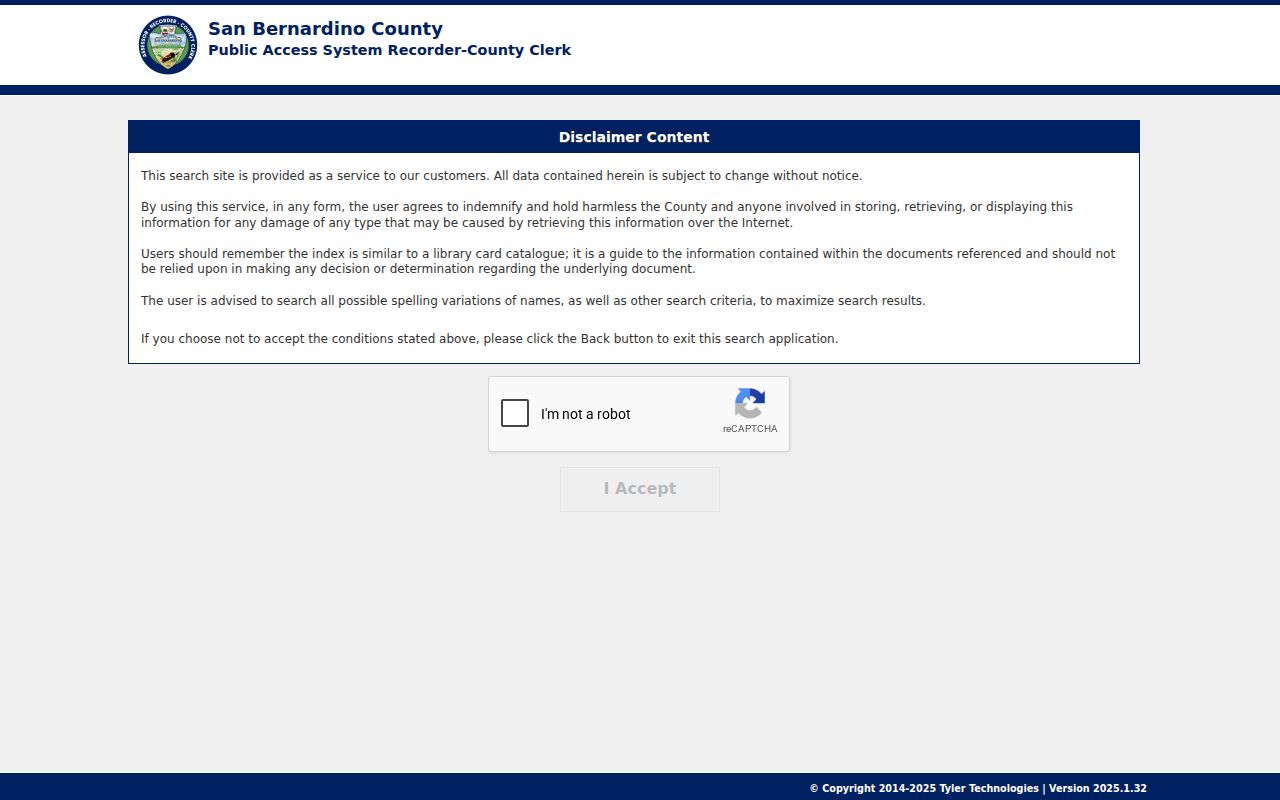
Before the online chain window, the main Recorder office has decade microfilm. County Historical Archives holds Assessor Lot and Parcel Books from 1895 to about 1950, arranged by school district and legal description. Archives: 909-386-8751; its online database was reported temporarily disabled.
Redlands Permits and Cityworks Context
Permits add a date and project clue, but jurisdiction at the time controls. Redlands Building Safety's status page needs a permit number. Its permit list filters types. Request an underlying card or plan by address, permit, and date through the city's public-records route.
The permit-status page has one visible field, Permit Number, so an address alone is not a promised result. Cityworks PermitsPlus and GoEnforce categories include hazardous condition, illegal construction, property maintenance, signs, vacant lot, vehicle abatement, and zoning. A category is not proof of wrongdoing.
The Redlands permit-status page is the source for the assigned image below.
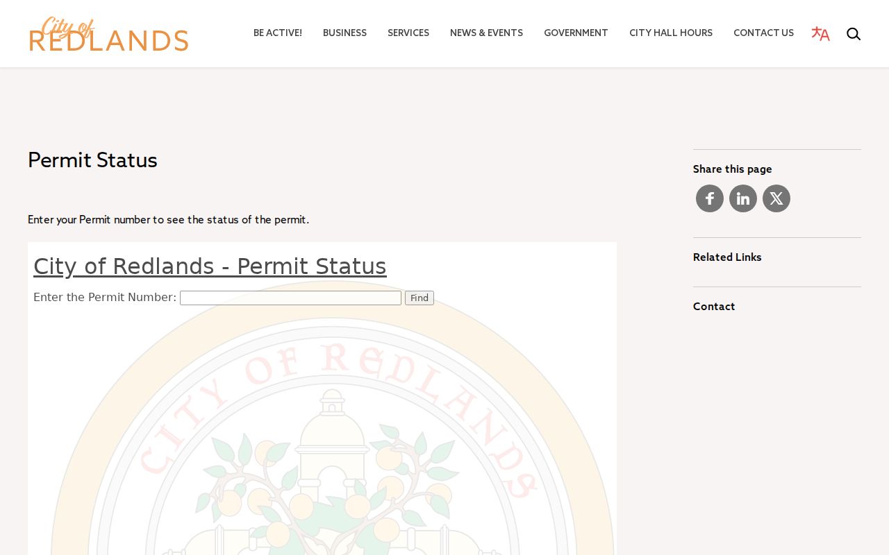
A missing result can mean that a number is needed, another jurisdiction holds the record, or the underlying file is not exposed. It does not prove that no record exists.
The city's permit-list search is the source for the category image below. It narrows types such as demolition, electrical, plumbing, roofing, solar, additions, remodels, garages, pools, signs, fences, and planning items. Ask for an existing card or plan by address, permit, and date through CPRA.
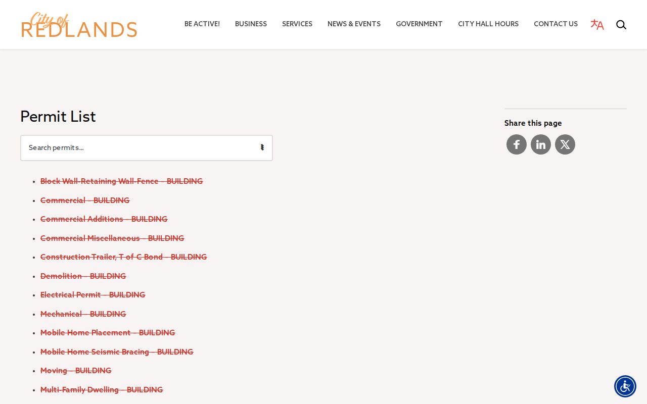
Permit evidence is strongest when paired with the APN, legal description, event date, and the jurisdiction that controlled the parcel.
Redlands ZIP Labels and City Jurisdiction
A postal city is not a city boundary. Redlands has 92373 south and central, 92374 north and east, and 92375 in a PO-box and routing role. USPS answers delivery; City GIS adds City Boundary, Sphere of Influence, Jurisdiction, and ParcelInRedlands.
The 2014 USPS bulletin moved 92374 and 92375 label-container routing from “REDLANDS CA 92373” to “REDLANDS CA 92374.” That is routing history, not proof of a municipal change or street renumbering.
Keep situs, mailing line, and legal description apart. They may align, but none alone proves occupancy or jurisdiction. Save the APN and access date for estate or civic research.
For a ZIP question that narrows the street set, the Redlands ZIP code directory explains the delivery areas and the city-line check before street-level records are compared.
What Redlands Street Records Leave Out
No public Redlands street directory provides a complete occupant roll. Assessment files focus on parcels, deeds on parties, GIS on mapped land, and permits on applications or categories. Household members, utility customers, DMV address holders, and protected voters are not a public street list.
Use address records for genealogy, reunions, estates, civic questions, and property history. Check the custodian when a fact matters. A real APN or document number in a letter does not prove that the sender is a government office.
Lawful personal use. Redlands address and parcel records are for lawful personal research. California Penal Code §646.9 and Civil Code §1708.7 prohibit stalking, harassment, and related abuse; do not use a street directory to threaten, intimidate, or harm anyone.